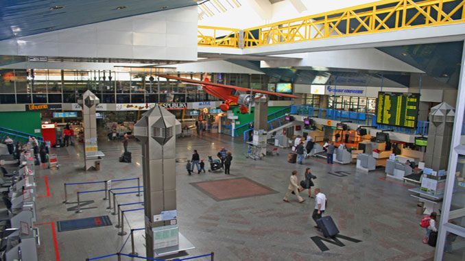
Passengers can now use Google Maps to study the interior of Vilnius Airport.
Using the Google service, passengers can discover the layout of arrival and departure areas, the names of shops and eating areas as well as their exact locations.
For many passengers negotiating an airport can be an unpleasant and stressful experience. So airports worldwide are looking to help passengers get around easier.
Vilnius Airport believes that the transfer of internal layouts to virtual space is a necessary step towards adjusting to the changing habits of passengers and their increasing needs.
See Vilnius Airport on Google Maps.
Indrė Baltrušaitienė, Head of Communication and Marketing Division of Lithuanian Airports:
“Travelling is not an exclusively pleasant experience for everyone; often it causes stress since many people are nervous before a flight, particularly if it is in an unfamiliar airport. It is important for us to make sure that our passengers’ experience is as pleasant as possible, so we are always looking for solutions that would allow them to feel comfortable and at ease. This online map of the inside of Vilnius Airport will certainly help to prepare for a trip in advance. In addition, travellers will be able to see on the map where they would prefer to spend time before their flight.”
N.B. Image credit: Vilnius Airport