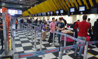
São Paulo Congonhas Airport in Brazil is the first airport in South America to be added to Google Street View.
São Paulo is one of the most important cities involved in the FIFA World Cup to be played in Brazil in 2014 so this new feature will be welcomed by large numbers of foreign visitors who can now view the internal areas of São Paulo Congonhas (CGH) in just a few clicks.
CGH is the third busiest airport in Brazil for passengers and handles only domestic traffic, almost 17 million passengers in 2012.
Google did the filming over a 15 day period in late 2012.
Google Street View transit locations helps wayfinding
Apart from Congonhas, Google has now photographed 15 other international airports – such as Barajas, Madrid, and London Gatwick – 50 over metro and train stations and a cable car in Hong Kong and the inside of an Emirates Airbus A380 at Dubai Airport.
Google has published an interactive map showing the new Street View transit locations.
Strangely with the World Cup just 7 months away the press release is only available in Portuguese.