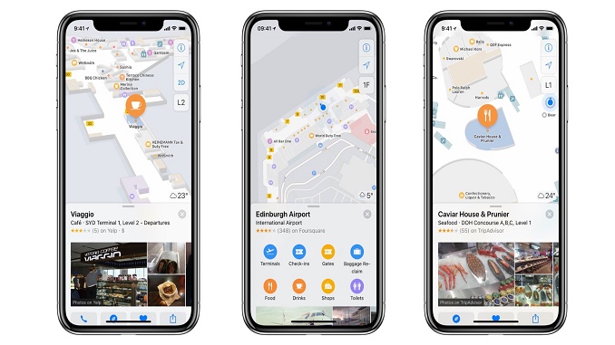
Apple has added three major international airports to its list of indoor mapping locations. Passengers can now use their iPhone and iPad to explore Sydney International, Edinburgh and Hamad International.
Indoor mapping for airports lets Apple Maps users explore the internal layout of buildings across multiple floors, with precise location positioning to help passengers find their way around.
With Indoor Maps, passengers can get detailed directions inside major airports around the world. They can find check-in areas, restrooms, shops and places to eat and baggage carousels.
Passengers on a flight to or from these airports in the future can navigate to the map and ‘look inside’ ahead of time to get a feel for the layout. When they arrive, location services pinpoint exactly where they are in the building.
Maps offers up common filters as part of the airport’s summary card, so passengers can just tap to search for terminals, check-ins, gates, baggage claim, food, shops and toilets. They can also ask Siri to navigate to their gate or nearby restaurants, for instance.
How it works
To start indoor mapping, passengers zoom into a supported location. When the zoom level is close enough, Maps switches from the standard map to focus on the indoor POIs and layout. It adds a floor level selector to the top right of the screen.
Indoor mapping is highlighted by a ‘look inside’ label next to the map badge – which passengers can tap as a shortcut to jump in.
There are now 59 airports that Apple has indoor mapping data for. See the full list here.
N.B. Image credit: Apple


