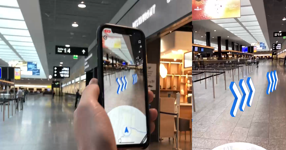
Google has activated the Live View feature in Google Maps at Zurich Airport, making it the first airport in the world with this function.
It means passengers can use their phone camera to find their way around the airport.
Live View now knows much more precisely the location of objects inside a building. It uses augmented reality (AR) and is powered by a technology called global localization that uses artificial intelligence (AI) to scan tens of billions of Street View recordings to understand user’s orientation.
Thanks to new advancements that help determine the precise altitude and placement of objects inside a building, Live View can now be used inside buildings such as airports.
So it can help passengers find the nearest lift, escalators, bag drops, security checks, shops, lounges, gates, water fountains etc.
If lost, passengers can point their phone camera at something like an escalator. Live View knows where that is and so can show passengers how to get from there to somewhere else in the building. Arrows and directions on the phone point passengers the right way.
New Google Maps functions and navigation are planned for Zurich Airport in 2022.
How it works
To use Google Maps Live View, users just need to launch the Google Maps app, enter their destination and select the “Live View” symbol, which looks like a compass needle.
The smartphone camera then opens and the route, plus other key information, is shown directly in camera mode.
Zurich Airport has a fine video showing it in action (in a very quiet terminal).
N.B. Image credits: Zurich Airport